New 3D atlas for map lovers
As of 20 June, users can access the Atlas of Switzerland online and free of charge. For the multi-award-winning map series, this marks the end of the era of offline media.
The Atlas of Switzerland debuted in 1965 in print form. Since then, much has changed. Research has added massively to the store of knowledge, mountains of statistical data have formed, and people have driven technology forward in all respects. These trends have left their mark on the Atlas of Switzerland, too. Starting in early summer 2016, this comprehensive collection of specialised maps, which has won multiple awards, will for the first time be made available for free online. This means that for this map series, the age of paper and CDs is now over. The data do not have to be installed on the user’s computer, but can be conveniently accessed with an app – a miniprogram that helps to display the data.
Navigating freely through the 3D maps
For this latest edition of the Atlas, the most striking change is the redesign of its user interface and menu structure. The former now reflects the principles of user-centred design, and allows users to simply and intuitively open up the maps and work with them. The user interface automatically adjusts the maps to the size of the screen.
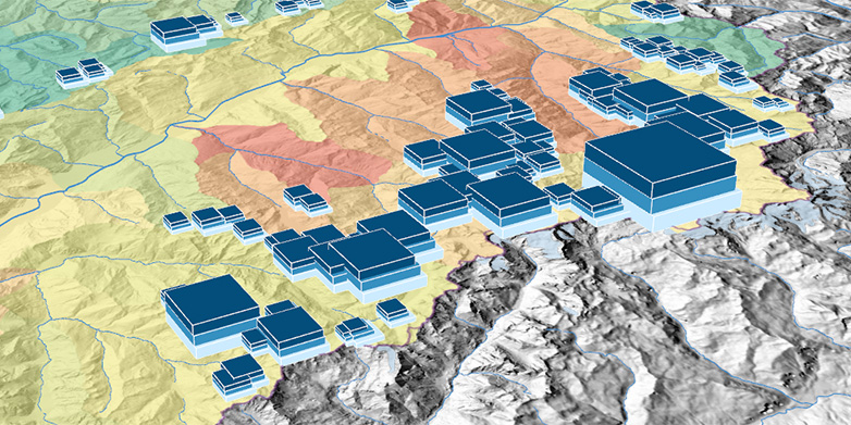
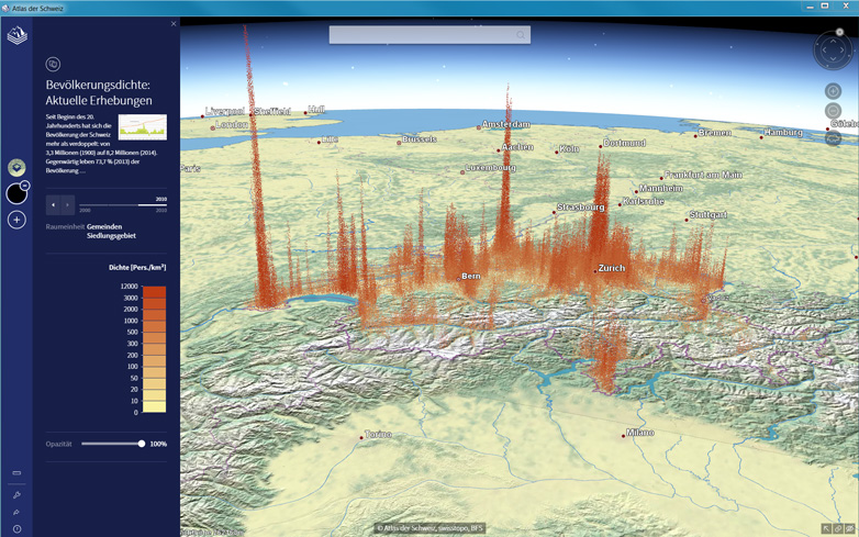
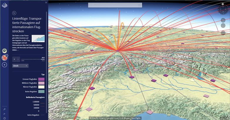
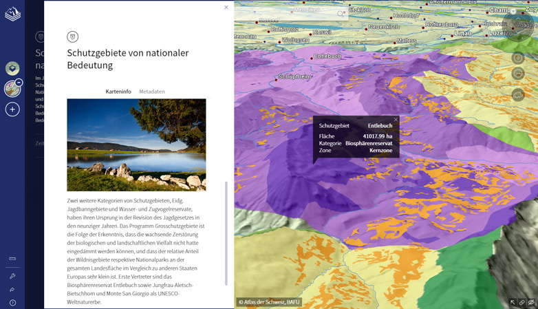
One new feature of the online version of the Atlas is that the 2D maps can be seamlessly rendered in 3D views – something that was not yet possible in the last edition. Another novelty is that the cartographers used a virtual 3D globe as the basis for the Atlas. This means users can navigate the maps using functions such as continuous zooming and panning, and can also move about freely in the virtual space. As a result, they can experience topography and thematic data directly and delve deeply into the maps.
The online Atlas still offers the tried and tested collection of map topics, such as geological maps in the “Nature and environment” category. And in the new category of “History and the future”, users can for example view changes in the population distribution of Switzerland over time.
Atlas of Switzerland - online

Deepest valley, tallest building
The makers of the Atlas have also included easy-to-access topics in the “Portrait of Switzerland” category. Here users can browse data on records, such as the country’s highest and lowest points or the oldest skyscraper in Switzerland. “Topics like these are a springboard for diving into the atlas,” says project manager René Sieber from the Institute of Cartography and Geoinformation (IKG) at ETH Zurich.
In addition, the digital version of the Atlas of Switzerland displays further information in separate windows. This makes the atlas not just a collection of maps, but instead a kind of wiki.
Overall, the online version contains fewer individual sub-topics than the DVD version from 2010. “We wanted to redesign the tool to be somewhat more streamlined,” explains Sieber. Several maps, such as those on voting behaviour, were dropped; others were merged together. However, links are provided that can still be used to access the source data.
Developed at ETH Zurich
The “Atlas of Switzerland – online” was developed at ETH Zurich’s Institute of Cartography and Geoinformation (IKG) in close cooperation with the Swiss Federal Offices of Topography, Statistics and the Environment, plus some 70 other institutions.
The IKG is also responsible for preparing and processing the data. “In putting together these maps, the true scientific achievement lies in the careful review, evaluation and editorial processing of the data used,” says editor in chief Professor Lorenz Hurni. He notes how lengthy and expensive this process is, especially because the data come from a wide range of sources and contained some errors.
Another aspect of great concern to the researchers was the graphical representation of the data. They took pains to draw up a special form of visualisation for each data set, carefully selected the colours and constantly found new ways to present the facts in an engaging way.
Besides Hurni and Sieber, just four other people from ETH helped to create this monumental map series: two IT developers and two scientific editors. Hurni was pleased with their efforts: “Our Atlas allows us to compete with Google. With respect to resources, the playing field is far from level, but we’ve definitely mastered the challenge, both in technical terms and by presenting meaningful thematic data.” The Atlas is aimed not just at schools and non-scientific users, but also at experts and media professionals.
The first Atlas of Switzerland was commissioned by the Swiss Federal Council and appeared in 1965. Over the next 40 years it depicted the geographical diversity of Switzerland using 600 printed thematic maps. In 2000, the Atlas was offered in a digital format (on CD-ROM) for the first time. Expanded and updated editions followed in 2004 and 2010, available on CD or DVD. This latest, completely overhauled collection is the first that can be used online for free. The maps are not stored on an anonymous server in the cloud; all the data of the “Atlas of Switzerland – online” are stored on a server cluster located at the ETH Zurich Institute of Cartography and Geoinformation.
Atlas of Switzerland – online: Presentation at ETH
An app is required in order to use the Atlas of Switzerland. It can be downloaded for free from the website: external pagewww.atlasofswitzerland.ch
On 29 June 2016 at 5:30 p.m., the makers of the Atlas will present it at ETH Zurich in the main building, Rämistr. 101, lecture theatre E 1.1. The presentation is open to the public and free of charge.