Flash Floods and Desert Claims
Deserts are among the roughest places to live on earth. Fauna and flora in the desert develop special adaptations to survive in such a harsh environment. So do humans. Our Landscape Modeling and Visualizing Studio investigated future scenarios for water-restrained settlements in the Sonoran Desert of Arizona.
Many countries around the globe are faced with a desert problematic that has become increasingly urgent in the context of a changing environment. The desert is inhospitable and defined by extremes: wet and dry, hot and cold, permanent and ephemeral. Surprisingly enough, one of the major threats to human life in Arizona is not rattle snakes or droughts but flash floods.
The recent Landscape Architecture Design Studio led by Professor Christophe Girot was proposed as an introduction to “desert design”, an emerging specialist area in architecture and related fields where the architecture of the landscape will come to play a vital role in its evolution. The studio worked towards structuring rainwater catchment, replenishing and distributing groundwater reserves in order to increase the autonomy from the Central Arizona Project for new resilient settlements in the Sonoran Desert of Arizona near the US–Mexico border. It primarily addressed the challenge of large-scale landscape and urban design in an area southwest of the city of Tucson prone to flash floods and severe erosion.
Studio problem set
The studio focused on the dynamics of water systems and the development of a holistic design approach integrating topography, vegetation, human settlement and activities. We asked the students to study and to simulate manipulations of the local topography so that flood waters could be retained for seasonal settlement and periodic cultivation. The goal of the studio was to develop several landscape approaches to a given site. Inspired by traditional farming of Southwest Native Americans, notoriously bean cultivations planted after the passage of flash floods, the students were to imagine how people could live in this very dry and hot landscape prone to flash floods in the summer, yet respecting an integral part of the American Southwest desert culture. Their solutions were expected to generate a broad range of topological possibilities and visions for potential future settlements.
Investigating the Sonoran Desert

A field trip to Arizona was undertaken with 20 ETH students together with 12 students from the Technical University in Delft to gain a precise insight into the situation at hand, combining site expeditions, presentations and workshops with group discussions. They worked toward the studio goal by digitally adapting architectural and landscape-architectural approaches related to topography, water dynamics, vegetation and existing settlement patterns found on site. The students subsequently assembled their specific strategies in landscape projects, each acting as a single whole. By combining advanced means of modeling and representation with regard to fluctuating water runoff, their work has helped to identify scale and define entirely new development strategies for the Sonoran Desert.
Implementing strategies
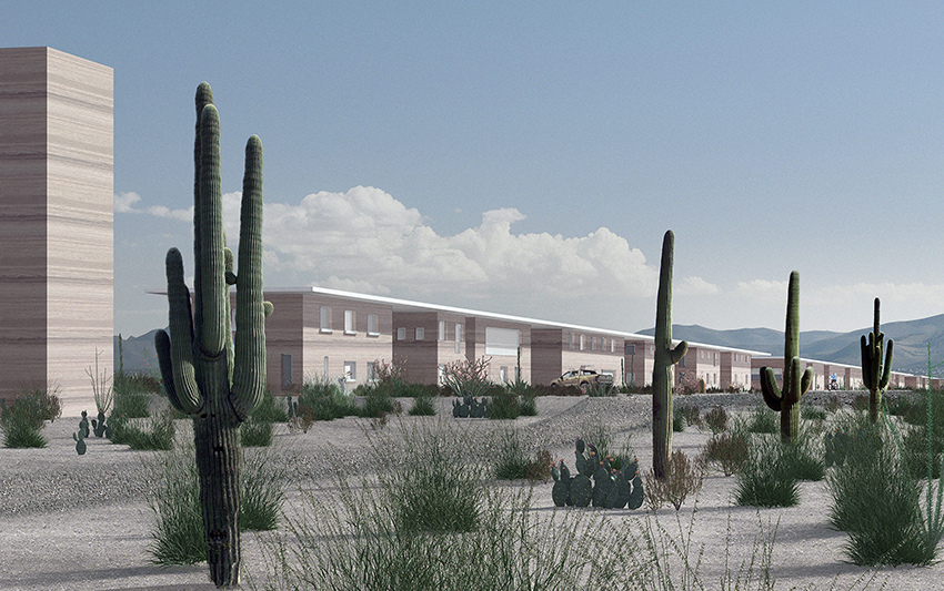
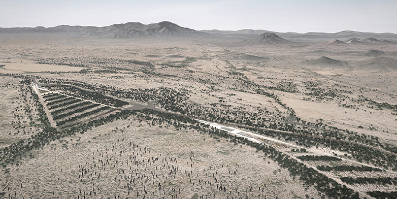
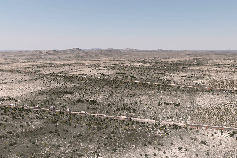
The students elaborated site-specific scenarios for a segment of the Brawley Wash, an ephemeral stream located in the Altar Valley, south-west of Tucson. The design approach both at architectural and landscape-architectural scales took into account the amplitude and dynamics of floods in relation to terrain, topography, vegetation and settlement. Analog tools were alternated with computer tools (3D visualization techniques and computer-aided manufacturing of prototypes) to develop precise topologies in the landscape at various scales. The scenarios include new settlements, desert landscape parks, research institutes and temporary agriculture. They rely on the specifically designed topographic modulations to capture, retain and distribute the fluctuating water runoff and represent a pertinent attempt to define new development strategies for the desert.
Philipp Urech has written this blog together with Christophe Girot.
Further information
Results of the “Flash Floods and Desert Claims” design studio are shown at the D-ARCH Annual Exhibition in the entrance hall of the HIL building on the Hönggerberg campus from September 25 to October 30.