The creation of Shangri-La
Geoscientists are using a new simulation to condense a period lasting millions of years to explain the formation of the high-lying valleys in the south-eastern end of the Tibetan Plateau: the true Shangri-La. In doing so, they are turning previous ideas on their head.
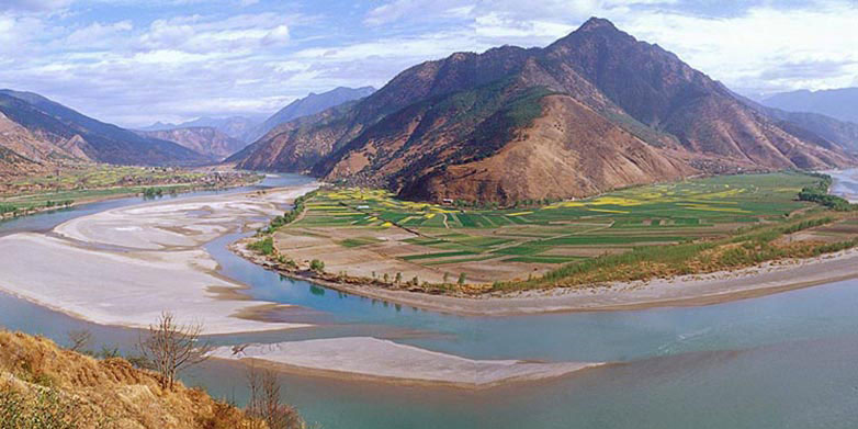
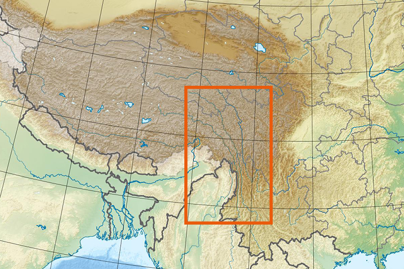
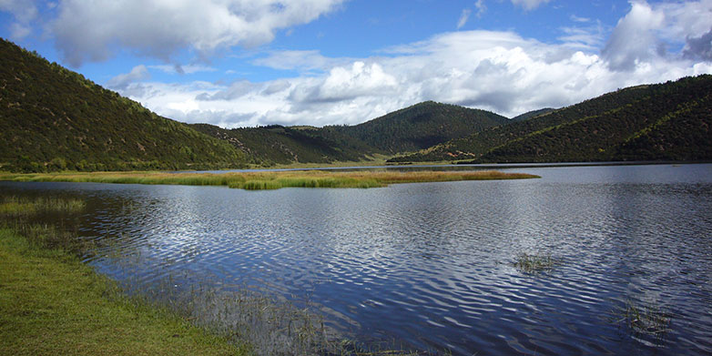
Located in Tibet and the Chinese province of Yunnan, the southeast Tibetan plateau is an extraordinary mountainous region. The high peaks are rugged and steep, reaching more than 7,000 meters in height. Major rivers, including the Yangtze, Mekong and Salween, have significantly eroded the bedrock. Nestled amongst the mountain ridges, however, are beautiful high valleys with gentle hills, large lakes and meandering rivers. This landscape inspired James Hilton's mystical Shangri-La, a heavenly, peaceful spot that became firmly entrenched in the minds of Westerners through his book, Lost Horizons.
Geoscientists take a somewhat less romantic approach to this area. Given that the geology is extremely interesting, they wish to find out how high valleys with the characteristics of Shangri-La came into being.
Elevation of the lowlands in dispute
It was previously assumed that these high valleys were relict landscapes, originating in the lowlands that lie at the foot of the Himalayas. According to this model, the continental collision and corresponding rise of the Tibetan plateau led to parts of the lowlands being lifted to their current elevation of between 2,000 and 5,000 metres above sea level. The characteristics of the landscape are thus thought to be preserved there.
Using a new computer model, geologists at ETH Zurich have now simulated the formation of these high-lying valleys. The simulations are a type of time lapse that enables the geologists to track the geological processes of the past 50 million years. As they recently disclosed in the journal Nature, the results of the study led them to a completely different conclusion.
Faults disrupt the network of rivers
In their simulation, they were not able to track preserved lowlands being uplifted into the highlands. In contrast, they demonstrated that the gentle, high valleys developed in place (in situ). This is due to a process of disruption of the river network induced by tectonic movement.
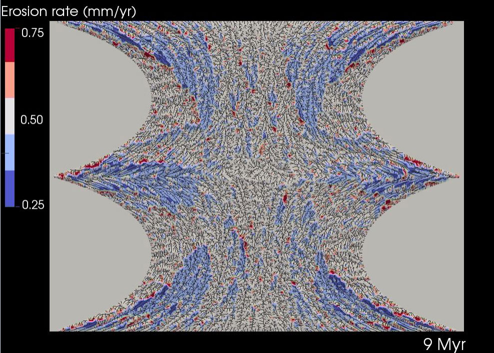
In this simulation (and, by inference, in reality), the north-eastern corner of the Indian Plate – today located in the province of Yunnan – pushes against the Asian plate and strongly "indents" the eastern Himalaya and Tibetan plateau. This results in large strain, accommodated by a succession of earthquakes that deform the Earth's surface along faults that cut across the landscape.
The deformation forces rivers to change course, shifting flow direction, and in some cases, disrupting watercourses such that rivers lose part of their catchment area. If, for example, a tributary disappears, the remaining river will carry less water. The river’s capacity for erosion, or for the transport of sediment, are diminished, resulting in a lower steepness to the river. The rate of erosion is also reduced along the adjacent slopes, because the river undercuts hillslopes less aggressively. As a result, they erode less quickly, with hillslopes being less steep and landslides becoming a less frequent occurrence. Over the course of millions of years, this process leads to the formation of landscapes in the mountains that resemble those in the lowlands at lower elevation. For ETH Professor Sean Willett, co-author of the study, the results are clear: "Our simulations explicitly show that the high-lying valleys must have developed in place. They are not remnants of former lowlands."
As for glaciers creating the gentle shapes, Willett rules this possibility out as well. According to Willett, glaciation in the study region was limited to the highest summits. Although he states that this may have assisted in the erosion of high mountains and slopes, he concludes that rivers are solely responsible for the formation of the valleys.
The Engadin – another Shangri–La?
The results of the study do not apply exclusively to the eastern Himalayas; they offer revealing insights into other mountainous regions as well. The ETH Professor highlights the Engadin as an example from the Swiss Alps. The valley floor is high above sea level, but is flatter than would be expected from a purely glacial valley. There is much to suggest that the high-lying valley in the Engadin could have been formed in place at high altitudes, just like those in the highlands of south-eastern Tibet. "The Maloja Pass is not a normal pass because there is no incline, no steep headwall, on the Engadin side," Willett states. “It is as if the head of the valley has been cut off.”
Whether the Engadin and other high-lying alpine valleys actually conform to the geoscientists' current model will be clarified in an upcoming study.
Reference
Yang R, Willett S, Goren L. In situ low-relief landscape formation as a result of river network disruption. Nature, published online 22. April 2015; DOI: external page10.1038/nature14354