Valuable long-term data from the Clariden
Scientists have been measuring the accumulation and melting of ice on the Claridenfirn in the Canton of Glarus constantly for a century. Glacier researcher Andreas Bauder explains what makes these measurements so special and what can be concluded from them.
ETH News: Researchers have been measuring how ice and snow accumulate and melt on the Claridenfirn for 100 years. What makes this so special?
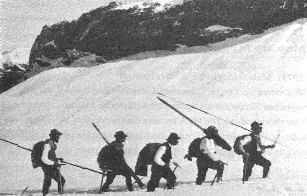
Andreas Bauder: This measurement series is the longest of its kind anywhere in the world. It’s also unique because researchers have recorded a constant level of detail since the beginning of the project. It isn’t just simple measurements where someone reads off a measuring instrument like a thermometer. The measurements on the Claridenfirn require a lot more effort.
What do the glacier researchers measure?
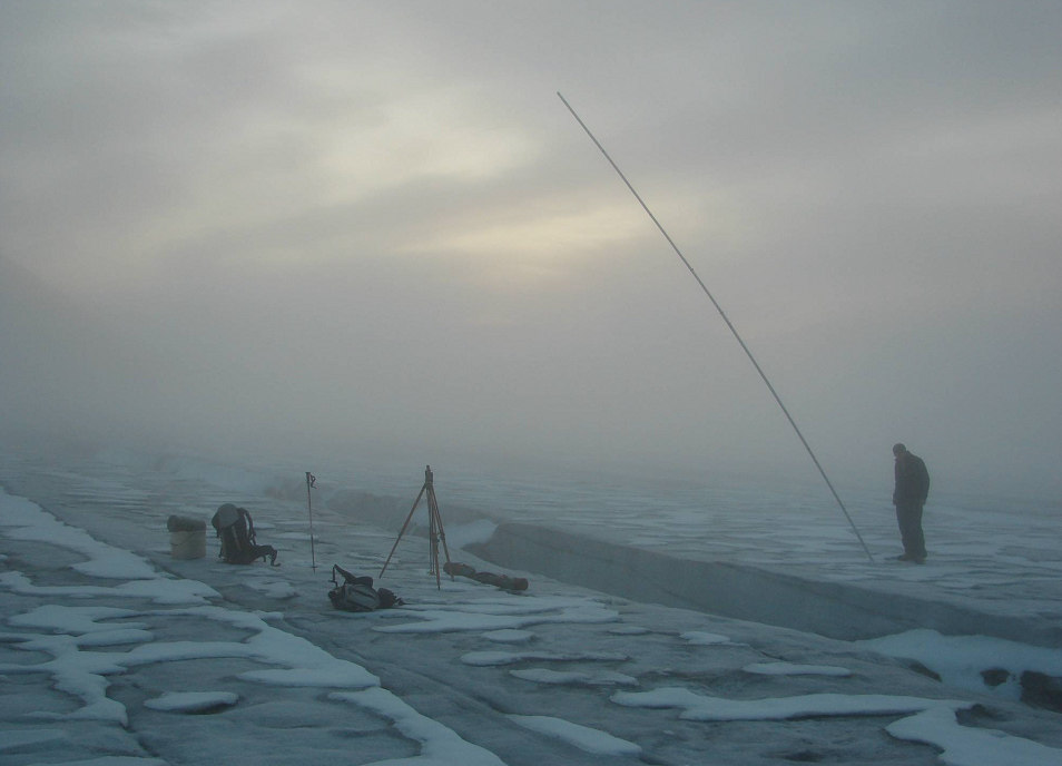
The researchers visit the glacier’s measurement sites twice a year to measure how much snow has accumulated during the winter or melted away in the summer months. But they can’t just drill a measuring rod into the ice and read off the metre count. If you want to measure changes in mass, you have to dig a pit down to the previous year’s level then measure the new layer in detail. We record not only its thickness, but also the density of the accumulated snow and firn.

How deep do you have to dig?
That varies a lot. In the spring of 2013, we had to dig down seven metres to reach the level from the previous autumn. Plus the shaft has be roughly as wide at the surface as it is supposed to be deep. There are also hard layers that you have to loosen with an ice axe, and you need space for that. If a layer is as high as the one in 2013, we measure it in stages starting from the top, which is extremely time-consuming.
Have the methods changed much in the last century?
No, hardly at all. We still use the same approach as the founders of the measurement series.
So the data from the past is largely comparable?
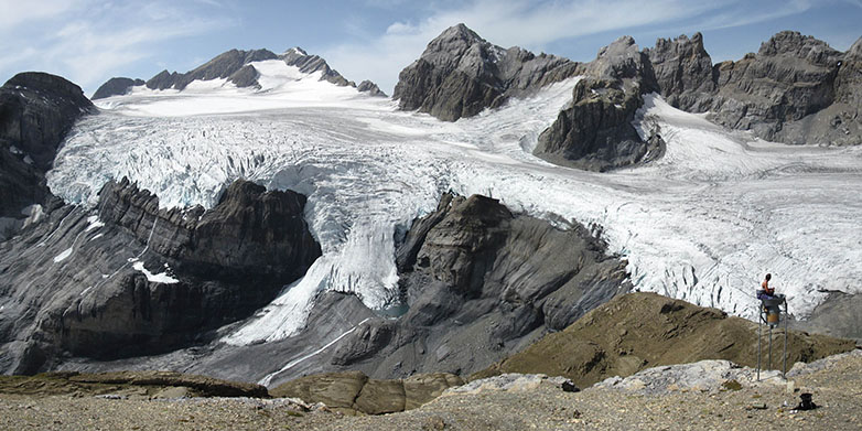
Yes, it is. The location of the Claridenfirn also helps in this respect. The glacier lies on a plateau and flows in a southerly direction down into the valley over a rock step. At the measurement sites on the plateau, the firn has hardly lost any thickness in all these years. This also means that the measurement sites have more or less remained in the same spot. The topographical conditions have remained intact over the last century.
Is that why the founders of the measurement campaign, including the famous Greenland researcher Alfred de Quervain, chose this location?
No. The Swiss Physical Society’s Zurich Glacier Committee (Zürcher Gletscherkommission der Physikalischen Gesellschaft), as it was known at the time, chose the Claridenfirn site because it was nearby, and because tourists visited the site regularly, which provided additional information. The commission initially aimed to measure the precipitation in the high mountain region. But this isn’t easy. You can’t measure snowfall with the funnels used for measuring rainfall; it’s more reliable to measure the thickness of the snow cover on the ground.
What do these time-series now reveal?
Glacier measurements often characterize the mass balance of the entire glacier. While that tells you something about the glacier’s water balance, it doesn’t help you to assess the climate’s influence on the glacier because every point on a glacier has its own climate. We obtain measurement data on the Claridenfirn at two measuring points, which enables us to draw inferences about how the climate at these locations affects the glacier.
And what impact does the climate have on the Claridenfirn?
Precipitation, which is responsible for the accumulation of snow, radiation and temperature are key factors. These parameters account for most ice melting and snow accumulation. Although the snow accumulation over the winter has been subject to fluctuations in the last century, it has largely remained steady. The melting in the summers, however, displays greater fluctuations and has become more intense.
What else could you infer from the data?
While analysing the measurement series, we realised that conditions haven’t always been the same in the last century. The air temperature is a good indicator of the rate of the melting. If you correlate the melting directly with the temperature, however, you can’t explain the full extent of the melt measured. In the 1940s, for instance, there were several years where the glaciers melted heavily, even though the average temperatures at the time were lower than in the 1990s or 2000s. Higher radiation intensity can account for the difference in the melt quantities, as revealed by a series of radiation measurements from Davos dating back to the 1940s. The data indicates a radiation peak in the 1940s, linked to natural fluctuations and how clean the atmosphere was.
Long-term monitoring has a hard time of it in modern science: too expensive, too much work, not enough scientific prestige. What’s next on the Claridenfirn?
It cuts both ways. On the one hand, such long streams of data are highly coveted in science. On the other hand, today’s university landscape doesn’t budget for such long-term monitoring projects. This measurement series also thrives on the enthusiasm of the people involved. In the beginning, members of Meteoschweiz were the driving force; in the meantime, private individuals have taken over, including Giovanni Kappenberger, who has been the head of the measurement programme since 1978.
Can the measurement programme look forward to sufficient funds thanks to its unique status?
There isn’t any sustainable funding as yet. We’re currently looking for a solution. There is a government initiative to keep supporting such measurement series. However, there isn’t a contract with the Claridenfirn measurement programme at present.
Can you at least devote some of your working hours to the measurements or enlist the help of student assistants?
I have often helped to take measurements, but more out of personal interest in my free time as the measurement campaign is not under my responsibility. But you can’t keep sending new people up the Claridenfirn every year, either. The measurements are no small matter – they take experience and Alpine expertise. It’s not simply a matter of reading off the values from a measuring instrument and writing down the numbers. A lot more effort goes into it than that.
About the interviewee
Andreas Bauder has been a scientist in the field of glaciology at the Laboratory of Hydraulics, Hydrology and Glaciology (VAW) since 2003. His main research interest is glacial changes in the Swiss Alpine region. He is also involved in the Swiss Glacier Monitoring Network.
Symposium to mark 100 years of measurements
To mark the 100th anniversary of measurements on the Claridenfirn, the Swiss Academy of Sciences and its Swiss Snow, Ice and Permafrost Society are organising an event with a scientific symposium at ETH Zurich on 22 August 2014 and an excursion to the glacier on the weekend of 23 and 24 August 2014.
external pageFurther Informationen